Active filters
Aucun filtre actif.
Jeu de données affiché :
\{\{ ctx.nhits | number \}\}
record
Filtres
Description
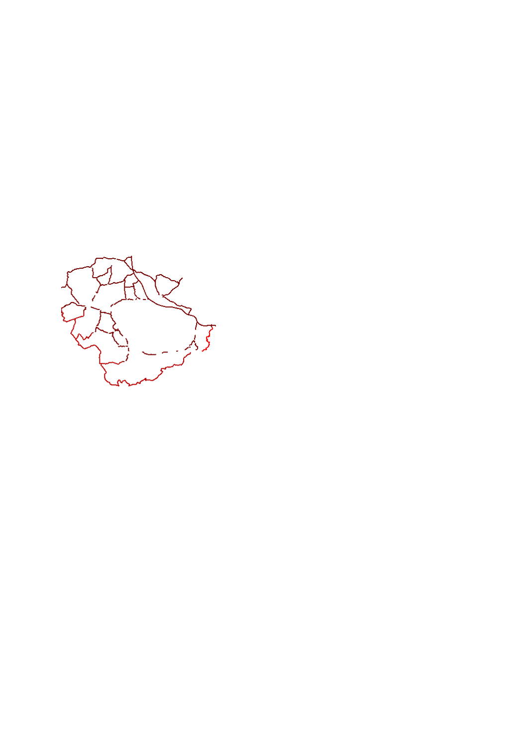
Tracés des clôtures mises en place pour la lutte contre la peste porcine africaine en Wallonie, Grand Est et Luxembourg
- Sources: SPW DEMNA (Wallonie), ANF (Luxembourg), DRAAF (Grand Est)
Limites techniques d'usage
Aucune limite technique d'usage des données renseignée
Informations géographiques
Type de représentation: non renseignée
Etendue géographique:
- Ouest: 5.08
- Est: 6.10
- Sud: 49.37
- Nord: 49.82
Système de projection: http://www.opengis.net/def/crs/EPSG/0/3857
Echelle: 1/100000
Résolution: non renseignée
Documents et ressources
African_swine_fever_fence_Luxembourg
https://ws.geoportail.lu/wss/service/GR_Agriculture_WMS/guest
Mots clefs
AgricultureAgriculture Peste porcine africaineGrande RégionPeste porcine clôturesgis-gr.eu
Synthèse
Mise à jour quand nécessaire
Publié le
\{\{'2019-06-06T00:00:00' | formatMeta:'date' \}\}
Thèmes
Contacts
SIG-GR - Ministère de l'Energie et de l'Aménagement du territoire - Département de l'aménagement du territoire
4, Place de l'Europe
1499 Luxembourg
Dataset schema
JSON Schema
The following JSON object is a standardized description of your dataset's schema. More about JSON schema.
Exports géographiques
-
WFS Agriculture:African_swine_fever_fence_Wallonia - https://ws.geoportail.lu/wss/service/GR_Agriculture_WFS/guest Consulter
-
WFS Agriculture:African_swine_fever_fence_France - https://ws.geoportail.lu/wss/service/GR_Agriculture_WFS/guest Consulter
-
WFS Agriculture:African_swine_fever_fence_Luxembourg - https://ws.geoportail.lu/wss/service/GR_Agriculture_WFS/guest Consulter
API Cartographiques
WFS
Flux cartographique WFS
https://ws.geoportail.lu/wss/service/GR_Agriculture_WFS/guest
Couche: Agriculture:African_swine_fever_fence_Wallonia
WFS
Flux cartographique WFS
https://ws.geoportail.lu/wss/service/GR_Agriculture_WFS/guest
Couche: Agriculture:African_swine_fever_fence_France
WFS
Flux cartographique WFS
https://ws.geoportail.lu/wss/service/GR_Agriculture_WFS/guest
Couche: Agriculture:African_swine_fever_fence_Luxembourg