Active filters
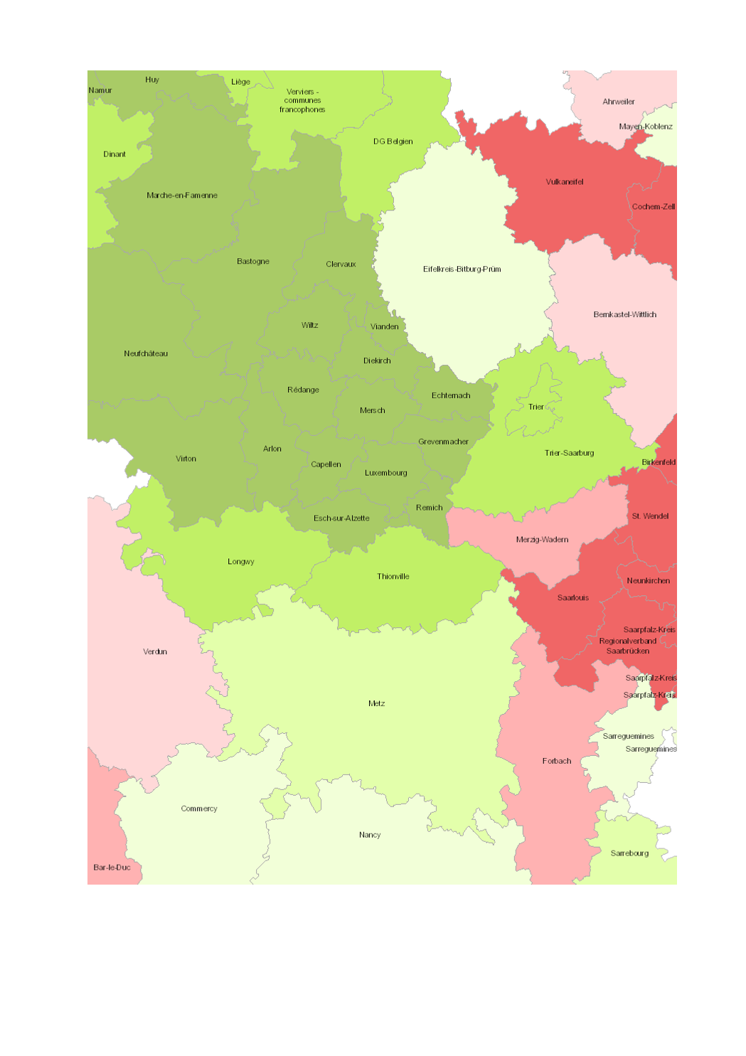
Evolution de la population totale 2000-2015 (zones d'emploi Lorraine: 1999-2013)
-
Unités territoriales: arrondissements (Wallonie), zones d'emploi (Lorraine), cantons (Luxembourg), Kreise (Saarland, Rheinland-Pfalz)
-
Sources des données statistiques: INSEE Grand Est; SPF Economie; STATEC; Statistisches Landesamt Rheinland-Pfalz; Statistisches Amt Saarland. Calculs: IBA / OIE 2016
-
Sources des données géographiques: EuroGeographics EuroRegionalMap v9.1 - 2016. Harmonisation: SIG-GR / GIS-GR 2016
Aucune limite technique d'usage des données renseignée
Type de représentation: non renseignée
Etendue géographique:
- Ouest: 2.84
- Est: 8.68
- Sud: 47.75
- Nord: 51.04
Système de projection: http://www.opengis.net/def/crs/EPSG/0/3857
Echelle: 1/249995
Résolution: non renseignée
DémographieDémographie Evolution de la populationGrande RégionPopulation évolutiongis-gr.eu
4, Place de l'Europe
1499 Luxembourg
Dataset schema
JSON Schema
The following JSON object is a standardized description of your dataset's schema. More about JSON schema.
Exports géographiques
-
WFS Population_change:Pop_change_2000_2015 - https://ws.geoportail.lu/wss/service/GR_Population_change_WFS/guest Consulter