Jeu de données affiché :
enregistrement
Filtres
Description
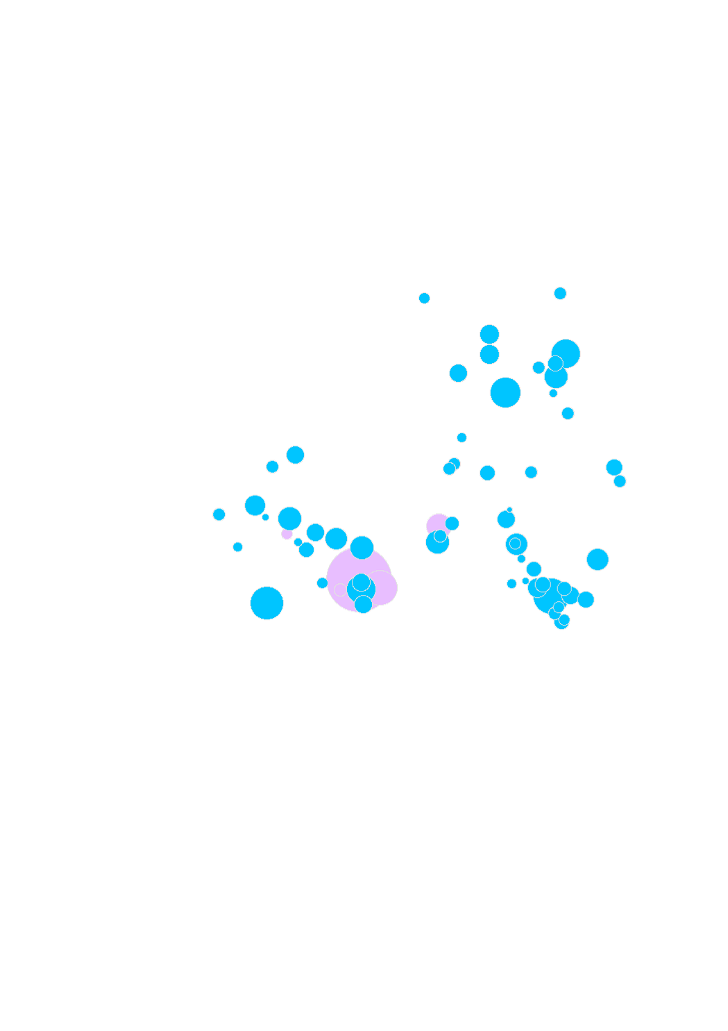
Aires de covoiturage dans un rayon de 40 km de la frontière luxembourgeoise (2016)
- Source: Groupe de travail Transport du Sommet de la Grande Région. Harmonisation: SIG-GR / GIS-GR 2016
Limites techniques d'usage
Aucune limite technique d'usage des données renseignée
Informations géographiques
Type de représentation: non renseignée
Etendue géographique:
- Ouest: 5.62
- Est: 7.01
- Sud: 49.27
- Nord: 50.02
Système de projection: http://www.opengis.net/def/crs/EPSG/0/3857
Echelle: 1/0
Résolution: non renseignée
Documents et ressources
Carpool_parkings_completed_2016
https://ws.geoportail.lu/wss/service/GR_Carpool_parkings_WMS/guest
Mots clefs
Covoiturage transportGrande RégionTransportsTransports Covoituragegis-gr.eu
Synthèse
Mise à jour quand nécessaire
Publié le
20 novembre 2018
Thèmes
Contacts
SIG-GR - Ministère de l'Energie et de l'Aménagement du territoire - Département de l'aménagement du territoire
4, Place de l'Europe
1499 Luxembourg
Pièces jointes
Cliquez pour déplier Cliquez pour replier
Modèle de données
Cliquez pour déplier Cliquez pour replier
gml_id
| Nom (identifiant) | gml_id |
| Type | texte |
| Description | Aucune description n'est disponible pour ce champ. |
| Exemple |
geo_point_2d
| Nom (identifiant) | geo_point_2d |
| Type | geo_point_2d |
| Description | Aucune description n'est disponible pour ce champ. |
| Exemple |
objectid
| Nom (identifiant) | objectid |
| Type | décimal |
| Description | Aucune description n'est disponible pour ce champ. |
| Exemple |
region
| Nom (identifiant) | region |
| Type | texte |
| Description | Aucune description n'est disponible pour ce champ. |
| Exemple |
name
| Nom (identifiant) | name |
| Type | texte |
| Description | Aucune description n'est disponible pour ce champ. |
| Exemple |
road
| Nom (identifiant) | road |
| Type | texte |
| Description | Aucune description n'est disponible pour ce champ. |
| Exemple |
parking_places
| Nom (identifiant) | parking_places |
| Type | décimal |
| Description | Aucune description n'est disponible pour ce champ. |
| Exemple |
de_access
| Nom (identifiant) | de_access |
| Type | texte |
| Description | Aucune description n'est disponible pour ce champ. |
| Exemple |
fr_access
| Nom (identifiant) | fr_access |
| Type | texte |
| Description | Aucune description n'est disponible pour ce champ. |
| Exemple |
en_access
| Nom (identifiant) | en_access |
| Type | texte |
| Description | Aucune description n'est disponible pour ce champ. |
| Exemple |
fr_marking_lighting
| Nom (identifiant) | fr_marking_lighting |
| Type | texte |
| Description | Aucune description n'est disponible pour ce champ. |
| Exemple |
en_marking_lighting
| Nom (identifiant) | en_marking_lighting |
| Type | texte |
| Description | Aucune description n'est disponible pour ce champ. |
| Exemple |
de_saturation
| Nom (identifiant) | de_saturation |
| Type | texte |
| Description | Aucune description n'est disponible pour ce champ. |
| Exemple |
fr_saturation
| Nom (identifiant) | fr_saturation |
| Type | texte |
| Description | Aucune description n'est disponible pour ce champ. |
| Exemple |
en_saturation
| Nom (identifiant) | en_saturation |
| Type | texte |
| Description | Aucune description n'est disponible pour ce champ. |
| Exemple |
de_status
| Nom (identifiant) | de_status |
| Type | texte |
| Description | Aucune description n'est disponible pour ce champ. |
| Exemple |
fr_status
| Nom (identifiant) | fr_status |
| Type | texte |
| Description | Aucune description n'est disponible pour ce champ. |
| Exemple |
en_status
| Nom (identifiant) | en_status |
| Type | texte |
| Description | Aucune description n'est disponible pour ce champ. |
| Exemple |
de_project_owner
| Nom (identifiant) | de_project_owner |
| Type | texte |
| Description | Aucune description n'est disponible pour ce champ. |
| Exemple |
fr_project_owner
| Nom (identifiant) | fr_project_owner |
| Type | texte |
| Description | Aucune description n'est disponible pour ce champ. |
| Exemple |
en_project_owner
| Nom (identifiant) | en_project_owner |
| Type | texte |
| Description | Aucune description n'est disponible pour ce champ. |
| Exemple |
de_services
| Nom (identifiant) | de_services |
| Type | texte |
| Description | Aucune description n'est disponible pour ce champ. |
| Exemple |
fr_services
| Nom (identifiant) | fr_services |
| Type | texte |
| Description | Aucune description n'est disponible pour ce champ. |
| Exemple |
en_services
| Nom (identifiant) | en_services |
| Type | texte |
| Description | Aucune description n'est disponible pour ce champ. |
| Exemple |
de_marking_lighting
| Nom (identifiant) | de_marking_lighting |
| Type | texte |
| Description | Aucune description n'est disponible pour ce champ. |
| Exemple |
Schéma JSON
L'objet JSON ci dessous est une description standardisée du modèle de votre jeu de données. Pour en savoir plus sur JSON schema.
{
- "title":"dcb61c22-e052-4d87-97f2-2dc66ad20fd6",
- "type":"object",
- "oneOf":,[
- {
- "$ref":"#/definitions/dcb61c22-e052-4d87-97f2-2dc66ad20fd6"
}
] - "definitions":{
- "dcb61c22-e052-4d87-97f2-2dc66ad20fd6":,{
- "properties":{
- "records":{
- "type":"array",
- "items":{
- "$ref":"#/definitions/dcb61c22-e052-4d87-97f2-2dc66ad20fd6_records"
}
}
} - "records":
} - "properties":
- "geoJSON":,{
- "title":"Geo JSON object",
- "description":"Schema for a Geo JSON object",
- "type":"object",
- "required":,[
- "type"
] - "properties":,{
- "crs":,{
- "$ref":"#/definitions/crs"
} - "bbox":{
- "$ref":"#/definitions/bbox"
}
} - "crs":
- "oneOf":[
- ,{
- "$ref":"#/definitions/geometry"
} - ,{
- "$ref":"#/definitions/geometryCollection"
} - ,{
- "$ref":"#/definitions/feature"
} - {
- "$ref":"#/definitions/featureCollection"
}
]
} - "bbox":,{
- "description":"A bounding box as defined by GeoJSON",
- "type":"array",
- "items":{
- "type":"number"
}
} - "crs":,{
- "title":"crs",
- "description":"a Coordinate Reference System object",
- "type":,[
- "object",
- "null"
] - "required":,[
- "type",
- "properties"
] - "properties":,{
- "type":,{
- "type":"string"
} - "properties":{
- "type":"object"
}
} - "type":
- "additionalProperties":false,
- "oneOf":[
- ,{
- "$ref":"#/definitions/namedCrs"
} - {
- "$ref":"#/definitions/linkedCrs"
}
]
} - "namedCrs":,{
- "properties":{
- "type":,{
- "enum":[
- "name"
]
} - "enum":
- "properties":{
- "required":,[
- "name"
] - "additionalProperties":false,
- "properties":{
- "name":{
- "type":"string"
}
} - "name":
} - "required":
} - "type":
} - "properties":
- "linkedObject":,{
- "type":"object",
- "required":,[
- "href"
] - "properties":{
- "href":,{
- "type":"string",
- "format":"uri"
} - "type":{
- "type":"string",
- "description":"Suggested values: proj4, ogjwkt, esriwkt"
}
} - "href":
} - "linkedCrs":,{
- "properties":{
- "type":,{
- "enum":[
- "link"
]
} - "enum":
- "properties":{
- "$ref":"#/definitions/linkedObject"
}
} - "type":
} - "properties":
- "geometryCollection":,{
- "title":"GeometryCollection",
- "description":"A collection of geometry objects",
- "required":,[
- "geometries"
] - "properties":{
- "type":,{
- "enum":[
- "GeometryCollection"
]
} - "enum":
- "geometries":{
- "type":"array",
- "items":{
- "$ref":"http://json-schema.org/geojson/geometry.json#"
}
}
} - "type":
} - "feature":,{
- "title":"Feature",
- "description":"A Geo JSON feature object",
- "required":,[
- "geometry",
- "properties"
] - "properties":{
- "type":,{
- "enum":[
- "Feature"
]
} - "enum":
- "geometry":,{
- "oneOf":[
- ,{
- "type":"null"
} - {
- "$ref":"#/definitions/geometry"
}
]
} - "oneOf":
- "properties":,{
- "type":[
- "object",
- "null"
]
} - "type":
- "id":{}
} - "type":
} - "featureCollection":,{
- "title":"FeatureCollection",
- "description":"A Geo JSON feature collection",
- "required":,[
- "features"
] - "properties":{
- "type":,{
- "enum":[
- "FeatureCollection"
]
} - "enum":
- "features":{
- "type":"array",
- "items":{
- "$ref":"#/definitions/feature"
}
}
} - "type":
} - "geometry":,{
- "title":"geometry",
- "description":"One geometry as defined by GeoJSON",
- "type":"object",
- "required":,[
- "type",
- "coordinates"
] - "oneOf":,[
- ,{
- "title":"Point",
- "properties":{
- "type":,{
- "enum":[
- "Point"
]
} - "enum":
- "coordinates":{
- "$ref":"#/definitions/position"
}
} - "type":
} - ,{
- "title":"MultiPoint",
- "properties":{
- "type":,{
- "enum":[
- "MultiPoint"
]
} - "enum":
- "coordinates":{
- "$ref":"#/definitions/positionArray"
}
} - "type":
} - ,{
- "title":"LineString",
- "properties":{
- "type":,{
- "enum":[
- "LineString"
]
} - "enum":
- "coordinates":{
- "$ref":"#/definitions/lineString"
}
} - "type":
} - ,{
- "title":"MultiLineString",
- "properties":{
- "type":,{
- "enum":[
- "MultiLineString"
]
} - "enum":
- "coordinates":{
- "type":"array",
- "items":{
- "$ref":"#/definitions/lineString"
}
}
} - "type":
} - ,{
- "title":"Polygon",
- "properties":{
- "type":,{
- "enum":[
- "Polygon"
]
} - "enum":
- "coordinates":{
- "$ref":"#/definitions/polygon"
}
} - "type":
} - {
- "title":"MultiPolygon",
- "properties":{
- "type":,{
- "enum":[
- "MultiPolygon"
]
} - "enum":
- "coordinates":{
- "type":"array",
- "items":{
- "$ref":"#/definitions/polygon"
}
}
} - "type":
}
] - "position":,{
- "description":"A single position",
- "type":"array",
- "minItems":2,
- "items":,[
- ,{
- "type":"number"
} - {
- "type":"number"
}
] - "additionalItems":false
} - "positionArray":,{
- "description":"An array of positions",
- "type":"array",
- "items":{
- "$ref":"#/definitions/position"
}
} - "lineString":,{
- "description":"An array of two or more positions",
- "allOf":[
- ,{
- "$ref":"#/definitions/positionArray"
} - {
- "minItems":2
}
]
} - "linearRing":,{
- "description":"An array of four positions where the first equals the last",
- "allOf":[
- ,{
- "$ref":"#/definitions/positionArray"
} - {
- "minItems":4
}
]
} - "polygon":{
- "description":"An array of linear rings",
- "type":"array",
- "items":{
- "$ref":"#/definitions/linearRing"
}
}
} - "dcb61c22-e052-4d87-97f2-2dc66ad20fd6_records":{
- "properties":{
- "fields":{
- "type":"object",
- "properties":{
- "gml_id":,{
- "type":"string",
- "title":"gml_id",
- "description":""
} - "geo_point_2d":,{
- "type":"array",
- "minItems":2,
- "maxItems":2,
- "items":,{
- "type":"number"
} - "title":"geo_point_2d",
- "description":""
} - "objectid":,{
- "type":"number",
- "title":"objectid",
- "description":""
} - "region":,{
- "type":"string",
- "title":"region",
- "description":""
} - "name":,{
- "type":"string",
- "title":"name",
- "description":""
} - "road":,{
- "type":"string",
- "title":"road",
- "description":""
} - "parking_places":,{
- "type":"number",
- "title":"parking_places",
- "description":""
} - "de_access":,{
- "type":"string",
- "title":"de_access",
- "description":""
} - "fr_access":,{
- "type":"string",
- "title":"fr_access",
- "description":""
} - "en_access":,{
- "type":"string",
- "title":"en_access",
- "description":""
} - "fr_marking_lighting":,{
- "type":"string",
- "title":"fr_marking_lighting",
- "description":""
} - "en_marking_lighting":,{
- "type":"string",
- "title":"en_marking_lighting",
- "description":""
} - "de_saturation":,{
- "type":"string",
- "title":"de_saturation",
- "description":""
} - "fr_saturation":,{
- "type":"string",
- "title":"fr_saturation",
- "description":""
} - "en_saturation":,{
- "type":"string",
- "title":"en_saturation",
- "description":""
} - "de_status":,{
- "type":"string",
- "title":"de_status",
- "description":""
} - "fr_status":,{
- "type":"string",
- "title":"fr_status",
- "description":""
} - "en_status":,{
- "type":"string",
- "title":"en_status",
- "description":""
} - "de_project_owner":,{
- "type":"string",
- "title":"de_project_owner",
- "description":""
} - "fr_project_owner":,{
- "type":"string",
- "title":"fr_project_owner",
- "description":""
} - "en_project_owner":,{
- "type":"string",
- "title":"en_project_owner",
- "description":""
} - "de_services":,{
- "type":"string",
- "title":"de_services",
- "description":""
} - "fr_services":,{
- "type":"string",
- "title":"fr_services",
- "description":""
} - "en_services":,{
- "type":"string",
- "title":"en_services",
- "description":""
} - "de_marking_lighting":{
- "type":"string",
- "title":"de_marking_lighting",
- "description":""
}
} - "gml_id":
}
} - "fields":
} - "properties":
} - "dcb61c22-e052-4d87-97f2-2dc66ad20fd6":
}
| objectid | parking_places | de_access | de_marking_lighting | de_project_owner | de_saturation | de_services | de_status | en_access | en_marking_lighting | en_project_owner | en_saturation | en_services | en_status | fr_access | fr_marking_lighting | fr_project_owner | fr_saturation | fr_services | fr_status | geo_point_2d | gml_id | name | region | road |
|---|
Aucun résultat